Ongoing Public Works and Capital Improvement Projects
FY 2017/2018 Pavement Rehabilitation Program
This project was funded in part by Measure X. This project involved the patching and overlay of various streets identified as part of the City’s SB 1 (The Road Repair and Accountability Act of 2017) project list for FY 2017-2018. Streets that were repaired and improved as part of this project included:
- 1st Avenue from Lincoln to Mission Street,
- 2nd Avenue from Lincoln Street to Dolores Street
- 5th Avenue from Monte Verde Street to Dolores Street
- 6th Avenue from Dolores Street to Lincoln Street
- 8th Avenue from Forest Road to Turn Around
- 8th Avenue from Scenic Road to Carmelo Street
- 12th Avenue from Monte Verde Street to San Carlos Street
- 13th Avenue from Camino Real to Monte Verde Street
- Dolores Street from Santa Lucia Avenue to Franciscan Way
- Mountain View from Santa Fe Street to Forest Road
- Oak Knoll Way from Forest Road to Turn Around
- Ocean Avenue from Monte Verde Street to Junipero Avenue
- Rio Road from Junipero Avenue to Santa Lucia Avenue
- San Carlos Street from 13th Avenue to Santa Lucia Avenue
- Scenic Road from 8th Avenue to Block A3 S End.
Construction occurred from March through September 2018. The useful life of replaced pavement is estimated at 10 years along primary arterials (Ocean Avenue and Rio Road) and 15-20 years along residential and collector streets.
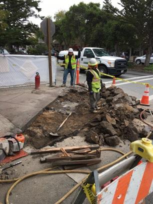


Storm Drainage Improvements Project
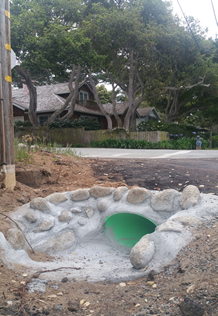
This project involves the repair and improvement of the City’s drainage infrastructure around Guadalupe and 5th Avenue. The current drainage line is located on private property and is maintained by the City. Accessing private property for proper maintenance is often limited and poses difficulties. This project re-routes the existing storm drain away from private property and onto City property for proper maintenance and to prevent flooding.
This project involves: 1) the installation of a new storm drain on 5th Avenue between Guadalupe Street and Torres Street, which includes the paving of 5th Avenue, 2) the installation of a new storm drain on Guadalupe Street from the south side of 4th Avenue mid-block to Guadalupe Street and 5th Avenue, and 3) the installation of a new storm drain from Carpenter Street between 4th and 5th Avenues to the south side of 4th Avenue between Carpenter and Guadalupe Streets.
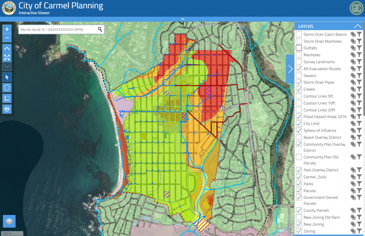
City Geographic Information System
This project involves the development of a Geographic Information System (GIS) framework and online web tool. GIS is a framework for organizing and analyzing spatial data. It is a powerful tool to help identify patterns, change over time, to support asset management and decision-making. There are many potential uses for GIS, including identifying locations of utilities and other City assets for project planning purposes, sharing information with development applicants on City zoning and special districts, managing our urban forest, etc. It is anticipated that the first phase of development of the City’s online GIS tool will be completed in December 2018.